By Location
By Species
What's In Season by Species
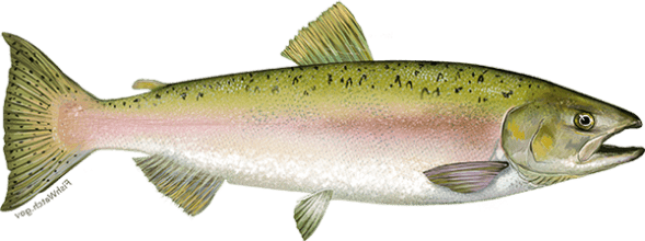
Showing all regulations for Pink Salmon.
- Not in Season
- Open in Limited Locations
- Open Season
Show All
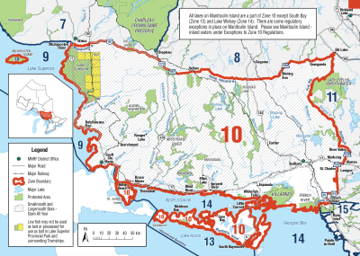
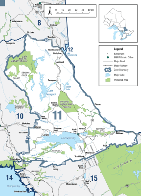
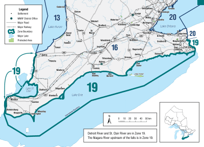
Zone 1

Season Start Date
Season End Date
Closed to fishing
Closed to fishing
Not present in this Zone and are closed to fishing all year
Zone 2
Season Start Date
Season End Date
Closed to fishing
Closed to fishing
Not present in this Zone and are closed to fishing all year
Zone 3

Season Start Date
Season End Date
Closed to fishing
Closed to fishing
Not present in this Zone and are closed to fishing all year
Zone 4
Season Start Date
Season End Date
Closed to fishing
Closed to fishing
Not present in this Zone and are closed to fishing all year
Zone 5
Season Start Date
Season End Date
Closed to fishing
Closed to fishing
Not present in this Zone and are closed to fishing all year
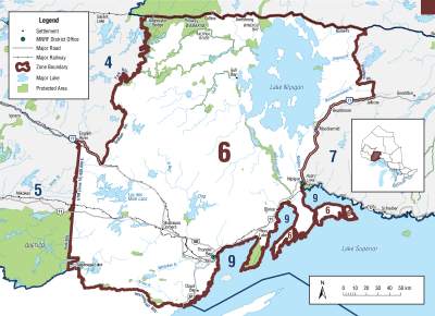
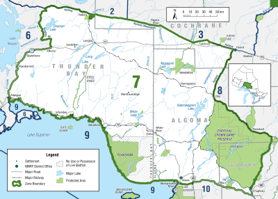
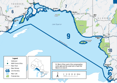
Zone 6
Season Start Date
Season End Date
Sport Limit
5
Conservation Limit
2
Total daily catch and possession limit for all trout, salmon and splake species combined
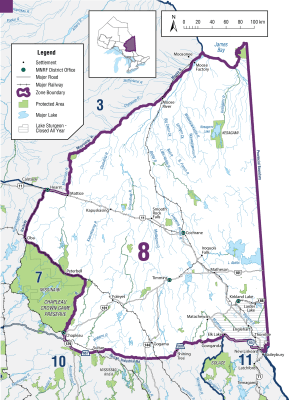
Zone 7
Season Start Date
Season End Date
Sport Limit
5
Conservation Limit
2
Total daily catch and possession limit for all trout, salmon and splake species combined
Zone 8
Season Start Date
Season End Date
Closed to fishing
Closed to fishing
Not present in this Zone and are closed to fishing all year
Zone 9
Season Start Date
Season End Date
Sport Limit
5
Conservation Limit
2
Total daily catch and possession limit for all trout, salmon and splake species combined
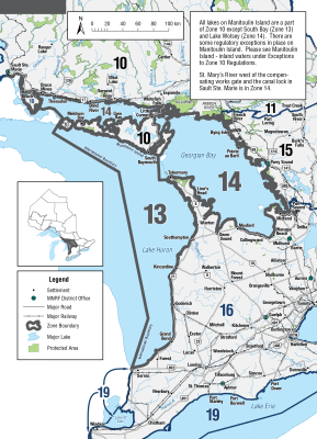
Zone 10
Season Start Date
Season End Date
Sport Limit
5
Conservation Limit
2
Total daily catch and possession limit for all trout, salmon and splake species combined
Zone 11
Season Start Date
Season End Date
Sport Limit
5
Conservation Limit
2
Total daily catch and possession limit for all trout, salmon and splake species combined
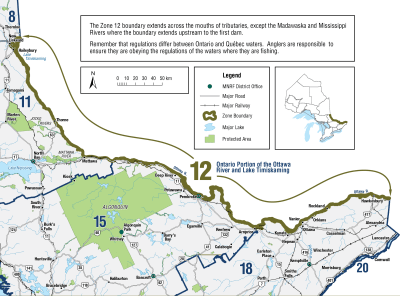
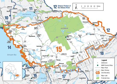
Zone 12
Season Start Date
Season End Date
Closed to fishing
Closed to fishing
Not present in this Zone and are closed to fishing all year
Zone 13

Season Start Date
Season End Date
Sport Limit
5
Conservation Limit
2
Total daily catch and possession limit for all trout, salmon and splake species combined
Zone 14
Season Start Date
Season End Date
Sport Limit
5
Conservation Limit
2
Total daily catch and possession limit for all trout, salmon and splake species combined
Zone 15
Season Start Date
Season End Date
Sport Limit
5
Conservation Limit
2
Total daily catch and possession limit for all trout, salmon and splake species combined
Zone 16
Season Start Date
Season End Date
Sport Limit
5
Conservation Limit
2
Total daily catch and possession limit for all trout, salmon and splake species combined
Additional Fishing Opportunities
Season Start Date
Season End Date
Sport Limit
5
Conservation Limit
2
Additional Fishing Opportunities
- Bayfield River - Goderich and Stanley Townships, from Highway 4 to the downstream side of the Highway 21 bridge (Huron County)
- Beaver River - Collingwood Township, from the Thornbury Dam to Georgian Bay (Grey County)
- Big Creek - Walsingham Township, south of the Quance Dam to Regional Road 21 at Lynedoch
- Big Otter Creek - Bayham Township (Elgin County)
- Bighead River - St. Vincent Township (Grey County)
- Bronte Creek - Town of Oakville from Highway 2 (Lakeshore Road West) upstream to the south side of Highway 407
- Credit River and tributaries - from the south side of Britannia Road in the City of Mississauga upstream to the south side of the Highway 407 Bridge in the City of Brampton
- Don River and tributaries - upstream from Eglinton Avenue in the City of Toronto to the south side of Highway 407 in the Regional Municipality of York
- Grand River - from a line across the Grand River in Paris at 100 m downstream of the Highway 2 (Dundas Street West) bridge to the edge of Lake Erie (see waterbody exceptions for catch and possession limits)
- Hog Creek - Tay Township from the C.P.R. bridge (Lot 10, Concession 6) downstream (north) to Georgian Bay (Simcoe County)
- Humber River and tributaries - upstream from Eglinton Avenue in the City of Toronto to the south side of the Highway 407 bridge in the Regional Municipality of York
- Little Otter Creek - Bayham Township, East branch of Big Otter Creek
- Little Sauble River - Bruce Township, from Highway 21 to Lake Huron (Bruce County)
- Maitland River - Colborne, Goderich, Hullett, East and West Wawanosh and Turnberry Townships, between County Road 4 and the downstream side of the Highway 21 bridge (Huron County)
- Nine Mile River (Lucknow River) - Ashfield and West Wawanosh Townships, between County Road 86 and Lake Huron
- North Creek - Middleton Township, downstream of Highway 3
- Rouge River - from Highway 2 (Kingston Road) in the City of Toronto upstream to the south side of Highway 407 in the Town of Markham
- Sauble River - Amabel Township, from the lowest ledge of Sauble Falls 440 m downstream to a line drawn perpendicular to the river’s current
- Saugeen River - Arran, Amabel, Brant, Elderslie and Saugeen Townships and in the Town of Walkerton and the Village of Paisley, between the southerly edge of the Municipality of Brockton Concession 2 SDR. bridge and the westerly edge of the concrete abutments downstream of Denny’s Dam
- Sixteen Mile Creek (Oakville Creek) and tributaries - Town of Oakville from Highway 2 (Lakeshore Road) upstream to the south side of Highway 407
- Sturgeon River and tributaries - Tay and Oro-Medonte Townships (Simcoe County), including the mouth of the Sturgeon River at Georgian Bay
- Young’s Creek - from the dam on Lot 23, Concession 3 to the downstream side of the Front Road bridge
Total daily catch and possession limit for all trout, salmon and splake species combined
Additional Fishing Opportunities
Season Start Date
Season End Date
Sport Limit
5
Conservation Limit
2
Additional Fishing Opportunities
- Black Creek - City of Nanticoke, from Highway 3 to the junction with the Lynn River
- Bronte Creek - Town of Oakville, from Highway 2 (Lakeshore Road West) to Lake Ontario
- Credit River and tributaries - City of Mississauga, from the south side of Highway 403 bridge downstream to Lake Ontario
- Don River and tributaries - City of Toronto, from Lake Ontario upstream to Eglinton Avenue
- Fifteen Mile Creek - City of St. Catharines and Town of Lincoln, between the Queen Elizabeth Way and Lake Ontario
- Forty Mile Creek - Town of Grimsby, between the Queen Elizabeth Way and Lake Ontario
- Grindstone Creek - City of Burlington, from Highway 2 (Plains Road) to Hamilton Harbour of Lake Ontario (City of Hamilton in the Region of Halton)
- Highland Creek - City of Toronto from the downstream edge of the Highway 2 (Kingston Road) bridge to Lake Ontario
- Humber River - City of Toronto, between Eglinton Avenue and Lake Ontario
- Nottawasaga River - from the Boyne River downstream (north) to Georgian Bay
- Rouge River - City of Toronto, between Highway 2 (Kingston Road) and Lake Ontario
- Sixteen Mile Creek (Oakville Creek) - Town of Oakville, from Highway 2 (Lakeshore Road) to Lake Ontario
- Sixteen Mile Creek - Town of Lincoln, between the Queen Elizabeth Way and Lake Ontario
- Spencer Creek - City of Hamilton, from Highway 102 (Cootes Drive) to Lake Ontario
- Thames River - Elgin County and Middlesex County and the Municipality of Chatham-Kent, main branch only
- Trout Pond of Waterford Ponds - City of Nanticoke
- Twelve Mile Creek (Zone 20) - City of St. Catharines, between Lakeport Road and Lake Ontario
- Twenty Mile Creek - Town of Lincoln, between the Queen Elizabeth Way and Lake Ontario
- Young’s Creek (Ryerse Creek) - Woodhouse Township, from the downstream side of the Front Road bridge to Lake Erie at Port Ryerse
Total daily catch and possession limit for all trout, salmon and splake species combined
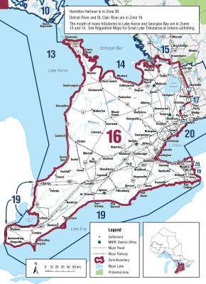
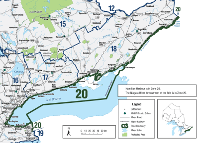
Zone 17
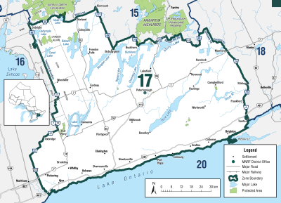
Additional Fishing Opportunities
Season Start Date
Season End Date
Sport Limit
5
Conservation Limit
2
Additional fishing opportunities
- Northumberland County - all waters downstream of Highway 2, except the Ganaraska River which may only be fished downstream of the south side of the C.P.R. bridge
- Regional Municipality of Durham - all waters between Highway 2 and the southerly limit of the C.N.R. right-of-way
Total daily catch and possession limit for all trout, salmon and splake species combined
Additional Fishing Opportunities
Season Start Date
Season End Date
Sport Limit
5
Conservation Limit
2
Additional fishing opportunities
- Cobourg Brook (Cobourg Creek or Factory Creek) - between the southerly limit of the C.N.R. right-of-way and Lake Ontario
- Gages Creek - between the southerly limit of the C.N.R. right-of-way and Lake Ontario
- Ganaraska River - between the southerly limit of the C.N.R. right-of-way and Lake Ontario
- Regional Municipality of Durham - all waters lying between the southerly limit of the C.N.R. right-of-way and Lake Ontario
Total daily catch and possession limit for all trout, salmon and splake species combined
Season Start Date
Season End Date
Sport Limit
5
Conservation Limit
2
Total daily catch and possession limit for all trout, salmon and splake species combined
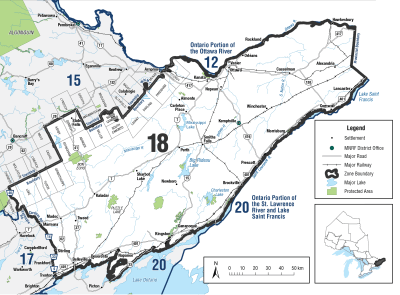
Zone 18
Season Start Date
Season End Date
Sport Limit
5
Conservation Limit
2
Total daily catch and possession limit for all trout, salmon and splake species combined
Zone 19
Season Start Date
Season End Date
Sport Limit
5
Conservation Limit
2
Total daily catch and possession limit for all trout, salmon and splake species combined
Zone 20
Season Start Date
Season End Date
Sport Limit
5
Conservation Limit
2
Total daily catch and possession limit for all trout, salmon and splake species combined
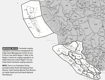
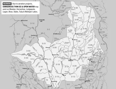
Region 1
Season Start Date
Season End Date
Closed to fishing
Closed to fishing
There is no fishing for salmon in Region 1 except for the opportunities listed below
Additional Fishing Opportunities
Season Start Date
Season End Date
Limit
4
Campbell River downstream of the confluence with the Quinsam River
Additional Fishing Opportunities
Season Start Date
Season End Date
Limit
4
Qualicum River
- those waters upstream of the Big Qualicum Hatchery upper weir (located approximately 125 m downstream of the E&N railway bridge).
- No fishing for salmon downstream of the upper weir (located approximately 125 m downstream of the E&N railway bridge) to the QFN boundary fence located approximately 100 m downstream of the hatchery counting fence Aug 15 - Oct 15
- No fishing for salmon in waters below the QFN boundary fence, downstream to the Hwy 19A bridge
- Hook restriction, single barbless hook less than 15mm in all open portions of the Qualicum River
Additional Fishing Opportunities
Season Start Date
Season End Date
Limit
4
Quinsam River
- 4 per day
Additional Fishing Opportunities
Season Start Date
Season End Date
Limit
0
San Juan River
- Non-retention
- That portion of the San Juan River from the hatchery counting fence downstream approximately 150 meters to square white boundary signs on either side of the river, and that portion of the Fairy Lake tributary approximately 5 meters downstream of the hatchery holding pens, indicated by square white boundary signs.
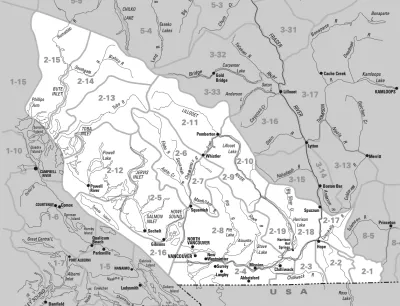
Region 2
Additional Fishing Opportunities
Season Start Date
Season End Date
Limit
0
Fraser River from the downstream side of the CPR Bridge at Mission upstream to the Highway 1 bridge at Hope. - Non-retention
Season Start Date
Season End Date
Closed to fishing
Closed to fishing
There is no fishing for salmon in Region 2 except for the opportunities listed below
Region 3
Season Start Date
Season End Date
Closed to fishing
Closed to fishing
There is no fishing for salmon in Region 3 except for the opportunities listed below
Region 4
Season Start Date
Season End Date
Closed to fishing
Closed to fishing
There are no salmon in Region 4
Region 5
Season Start Date
Season End Date
Closed to fishing
Closed to fishing
Kilbella River
- No fishing for salmon
Long Lake Including tributaries
- No fishing for salmon
Wannock River
- No fishing for salmon
Season Start Date
Season End Date
Closed to fishing
Closed to fishing
Docee River
- No fishing for salmon
Season Start Date
Season End Date
Closed to fishing
Closed to fishing
Dean River
- from signs located approximately 500 m upstream of the canyon to signs located approximately 100 m below the canyon.
- And upstream of the confluence with Crag Creek.
- No fishing for salmon
Season Start Date
Season End Date
Closed to fishing
Closed to fishing
Dean River
- From the confluence with Crag Creek downstream to the tidal boundary, except for the canyon as listed below.
- No fishing for salmon
Season Start Date
Season End Date
Closed to fishing
Closed to fishing
Chuckwalla River
- No Fishing
Additional Fishing Opportunities
Season Start Date
Season End Date
Limit
2
Bella Coola River including tributaries (not including Atnarko River)
Additional Fishing Opportunities
Season Start Date
Season End Date
Limit
2
Atnarko River including tributaries
Season Start Date
Season End Date
Closed to fishing
Closed to fishing
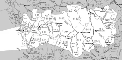
There is no fishing for salmon in Cariboo Part A - Fraser River Watershed: Management Units 5-1 to 5-5 and 5-12 to 5-16
Unless otherwise stated below, the daily limit for all waters in Cariboo Part B Coastal Watershed: Management Units 5-6 to 5-11 is zero (0).
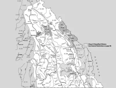
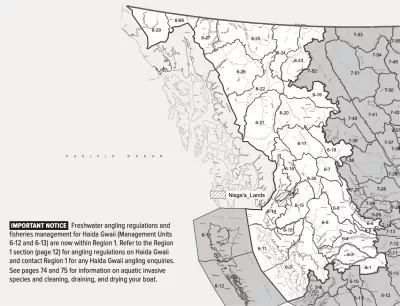
Region 6
Season Start Date
Season End Date
Closed to fishing
Closed to fishing
Oweegee Creek
Oweegee Lake
Season Start Date
Season End Date
Closed to fishing
Closed to fishing
All Region 6 waters
- All lakes or streams or parts thereof in the aggregate (combined total), in Region 6, unless otherwise stated
Season Start Date
Season End Date
Closed to fishing
Closed to fishing
Tseax R. (including tributaries)
- upstream of Nisga’a Hwy Bridge
- Note: The mouth of the Tseax R. is designated by white triangular fishing boundary signs located where what was formerly known as the Nass Back Channel enters the Nass R
Additional Fishing Opportunities
Season Start Date
Season End Date
Limit
2
Yakoun River
- downstream of the 6 mile Bridge
Season Start Date
Season End Date
Closed to fishing
Closed to fishing
Dala River (including tributaries)
Season Start Date
Season End Date
Closed to fishing
Closed to fishing
Dala River (including tributaries)
Season Start Date
Season End Date
Closed to fishing
Closed to fishing
Dala River (including tributaries)
Season Start Date
Season End Date
Closed to fishing
Closed to fishing
Endako River
Season Start Date
Season End Date
Closed to fishing
Closed to fishing
Khutzeymateen River
Season Start Date
Season End Date
Closed to fishing
Closed to fishing
Kitimat River (including tributaries)
- on west bank between signs at Kitimat hatchery outfall
Additional Fishing Opportunities
Season Start Date
Season End Date
Limit
2
Kitimat River (including tributaries)
- downstream of Highway # 37 bridge
Season Start Date
Season End Date
Closed to fishing
Closed to fishing
Kitimat River (including tributaries)
- upstream of Highway # 37 bridge
Season Start Date
Season End Date
Closed to fishing
Closed to fishing
Tahltan River (including tributaries)
- Finfish closure
Season Start Date
Season End Date
Closed to fishing
Closed to fishing
Tatsatua Creek (including tributaries)
Season Start Date
Season End Date
Closed to fishing
Closed to fishing
Tatshenshini River (downstream of the BC/Yukon border)
Season Start Date
Season End Date
Closed to fishing
Closed to fishing
Tatshenshini River (upstream of the BC/ Yukon border – along the Haines Hwy.)
- Blanchard River
Season Start Date
Season End Date
Closed to fishing
Closed to fishing
Tatshenshini River (upstream of the BC/ Yukon border – along the Haines Hwy.)
- Kwatini Creek, Stanley Creek and Goat Creek
Season Start Date
Season End Date
Closed to fishing
Closed to fishing
Tatshenshini River (upstream of the BC/ Yukon border – along the Haines Hwy.)
- Tatshenshini mainstem and all other tributaries
Season Start Date
Season End Date
Closed to fishing
Closed to fishing
Fraser River Watershed
- There is no fishing for salmon in the portions of the Fraser River watershed in Region 6
Season Start Date
Season End Date
Limit
0
Unless otherwise stated, the daily limit for all waters in Region 6 is zero (0)
Season Start Date
Season End Date
Closed to fishing
Closed to fishing
Meziadin River (including tributaries)
Season Start Date
Season End Date
Closed to fishing
Closed to fishing
All waters in section "B(i)" – Skeena River Watershed upstream of the CNR Railway Bridge at Terrace, unless otherwise stated
Season Start Date
Season End Date
Closed to fishing
Closed to fishing
Babine Lake within a 400m radius of the mouth of Pinkut Creek
Season Start Date
Season End Date
Closed to fishing
Closed to fishing
Bulkley River
- downstream of the Morice River confluence excluding tributaries
- No fishing
Season Start Date
Season End Date
Closed to fishing
Closed to fishing
Bulkley River and Morice River waters within the four white triangular fishing boundary signs located at the confluence of the Bulkley River and Morice River (locally known as “the Forks”). The closure starts 100 meters upstream of the confluence and ends approximately 1 kilometre downstream
Additional Fishing Opportunities
Season Start Date
Season End Date
Limit
2
Kispiox River (including tributaries)
- downstream of fishing boundary signs near Kispiox River Resort
Season Start Date
Season End Date
Closed to fishing
Closed to fishing
Morice Lake, including tributaries
Season Start Date
Season End Date
Closed to fishing
Closed to fishing
Morice River (including tributaries)
- from fishing boundary signs posted near the outlet of Morice Lake to Gosnell Creek
Season Start Date
Season End Date
Closed to fishing
Closed to fishing
Morice River (including tributaries)
- from Gosnell Creek to Lamprey Creek
Additional Fishing Opportunities
Season Start Date
Season End Date
Limit
2
Morice River (including tributaries)
- from the confluence of the Bulkley and Morice Rivers upstream to the Bymac Bridge on Walcott Road
Season Start Date
Season End Date
Closed to fishing
Closed to fishing
Morice River (including tributaries)
- upstream of the Bymac Bridge on Walcott Road
Season Start Date
Season End Date
Closed to fishing
Closed to fishing
Pinkut Creek
- downstream of fishing boundary signs located approx. 25 m downstream of fish counting fence
Season Start Date
Season End Date
Closed to fishing
Closed to fishing
Skeena River
- mainstem waters only, upstream of Cedarvale
Additional Fishing Opportunities
Season Start Date
Season End Date
Limit
2
Skeena River
- mainstem waters only
Season Start Date
Season End Date
Closed to fishing
Closed to fishing
Skeena River
- mainstem waters within 3 white triangular fishing boundary signs located at the confluence of the Kispiox River with the Skeena River
- mainstem waters near the Kitwanga River mouth, from Mill Creek upstream to the Highway 37 Bridge
Additional Fishing Opportunities
Season Start Date
Season End Date
Limit
2
Kitsumkalum River (including tributaries)
- downstream of railway bridge
Additional Fishing Opportunities
Season Start Date
Season End Date
Limit
2
Skeena River
- mainstem waters downstream of CNR Railway bridge at Terrace, BC, excluding mainstem waters near the Kitsumkalum River mouth, from the confluence with the Zymagotitz River (also known as Zymachord River) upstream to the Classified Waters boundary at the top of Hell’s Gate
Season Start Date
Season End Date
Closed to fishing
Closed to fishing
Skeena River
- mainstem waters near the Kitsumkalum River mouth, from the confluence with the Zymagotitz River (also known as Zymachord River) upstream to the Classified Waters boundary at the top of Hell’s Gate
Season Start Date
Season End Date
Closed to fishing
Closed to fishing
Nass River
- mainstem waters near the Meziadin River confluence, from white triangular fishing boundary signs located downstream of the Meziadin River confluence,and upstream to the Hwy 37 Bridge
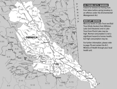
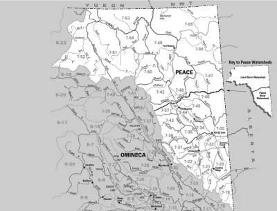
Region 7A
Season Start Date
Season End Date
Closed to fishing
Closed to fishing
Region 7B
Season Start Date
Season End Date
Closed to fishing
Closed to fishing
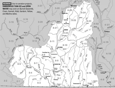
Region 8
Season Start Date
Season End Date
Closed to fishing
Closed to fishing
Copyright © 2026 What To Fish. All Rights Reserved.
Site by Sage
Solutions