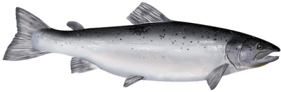
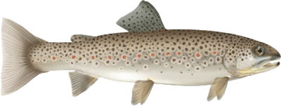
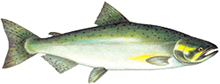
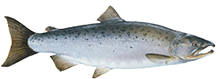
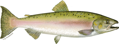
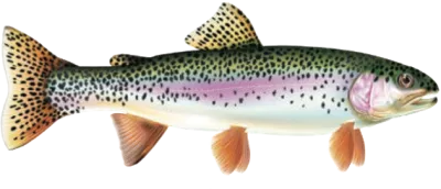
Atlantic Salmon, Brown Trout, Pacific Salmon and Rainbow Trout
Additional fishing opportunities
Season: open all year
Limits: Zone-wide limits apply
- Cobourg Brook (Cobourg Creek or Factory Creek) - between the southerly limit of the C.N.R. right-of-way and Lake Ontario
- Gages Creek - between the southerly limit of the C.N.R. right-of-way and Lake Ontario
- Ganaraska River - between the southerly limit of the C.N.R. right-of-way and Lake Ontario
- Regional Municipality of Durham - all waters lying between the southerly limit of the C.N.R. right-of-way and Lake Ontario
Season: open from fourth Saturday in April to December 31 (extended fall season)
Limits: Zone-wide limits apply
- Northumberland County - all waters downstream of Highway 2, except the Ganaraska River. Details of additional fishing opportunities for the Ganaraska River can be found below.
- Regional Municipality of Durham - all waters between Highway 2 and the southerly limit of the C.N.R. right-of-way
New Season: open from fourth Saturday in April to August 31 and from October 15 to December 31 (extended fall season)
Limits: Zone-wide limits apply
- Ganaraska River – from the south side of the Jocelyn Street Bridge (43° 58' 1.77" N., 78° 17' 43.77" W.) to the southerly limit of the CNR right-of-way (43° 56' 48.51" N., 78° 17' 31.93" W)
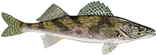
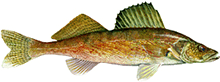
Walleye
Season: January 1 to March 1 and second Saturday in May to December 31
Limits: Zone-wide limits apply
- Crowe Lake (44°29′00″N., 77°44′00″W.) - Marmora Township, and the waters of the Crowe River (Marmora and Rawdon Townships)
Season: Zone-wide seasons apply
Limits: S-3 and C-1; none between 37-55 cm
- Balsam Lake (44°34′54″N., 78°51′10″W.) - Bexley Township, including the waters of the Gull River upstream to the dam at Coboconk, the waters of the Rosedale River between the Trent dam at Rosedale upstream to Balsam Lake, the waters of the Trent Canal between the upstream lock at Rosedale upstream to its junction with the Rosedale River and the waters of the Trent Canal between Balsam Lake and Mitchell Lake
- Mitchell Lake (44°34′46″N., 78°56′54″W.) - Eldon Township, including the waters of the Trent Canal between Mitchell Lake and Balsam Lake, and the waters of the Trent Canal between Mitchell Lake and lock number 36 at Kirkfield